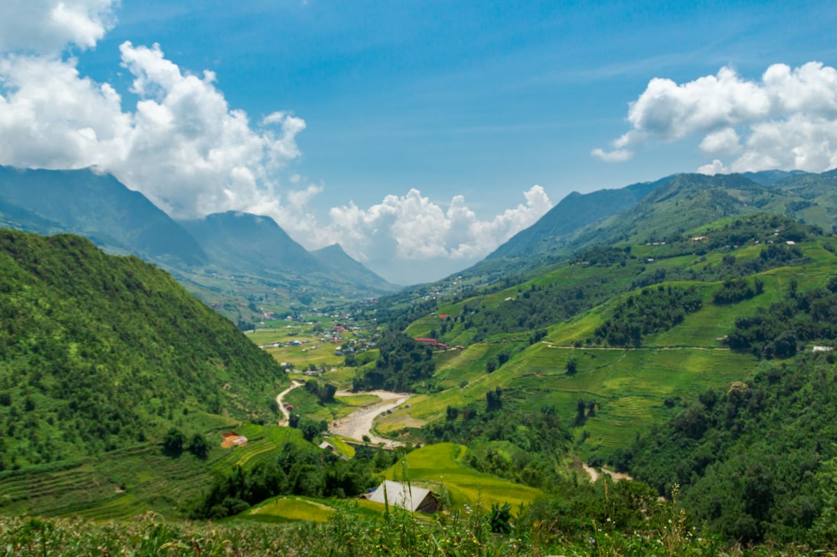
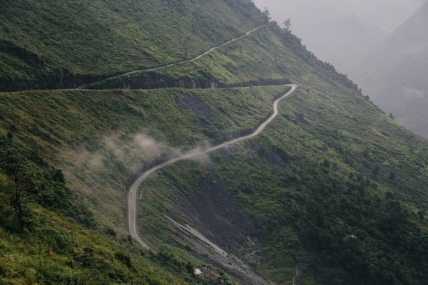
Sapa sits at around 1,500 metres in Vietnam's far northwest, above a valley of rice terraces cut into the hillsides over generations. The town itself has been built up heavily. The walking below it is why you come.
The main routes
The standard walk runs down the Muong Hoa valley through Lao Chai and Ta Van, two villages a few kilometres apart, and takes most of a day at an easy pace. It is the busiest route and still the best introduction: terraces on both sides, river crossings, and villages that people actually live in.
Beyond it, Ta Phin to the north is a shorter half-day loop through Dzao villages with fewer visitors. Ban Ho, lower and warmer, is usually done as a two-day trek and reaches a part of the valley most groups do not. Y Linh Ho is the steeper way into the main valley and is usually walked as the first leg.
How hard is it
Moderate rather than demanding on the standard route, with the honest caveat that the paths are earth rather than made trail. After rain they become genuinely slippery clay, and the descents are where people fall. Shoes with real grip make a large difference; smooth-soled trainers are the common reason people end up sliding.
Five hours of mountain road from Hanoi: Hanoi · Sapa. (Enable JavaScript for the interactive map.)
Fansipan
Indochina's highest peak at 3,143 metres sits above the town. There are two ways up. The cable car takes about fifteen minutes and deposits you near the summit, from where a long flight of steps or a funicular completes the climb. The trek is a hard two or three days with a guide and an overnight on the mountain.
Be realistic about the cable car: it arrives in cloud a great deal of the time, and on those days you pay for a view of white. Check the mountain before buying, and keep it flexible if you can.
When to go
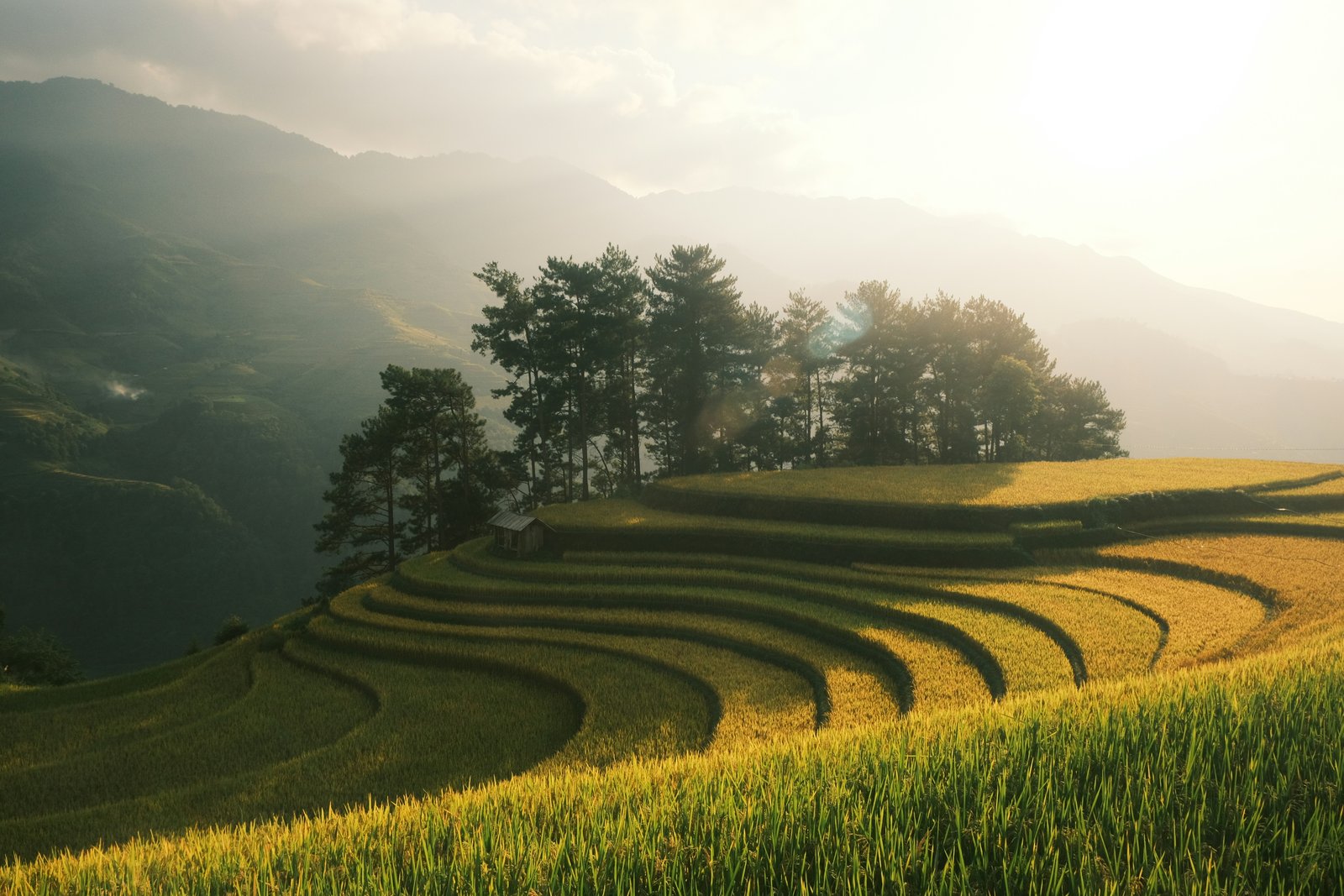
September and October are the window most photographers aim for, when the terraces are golden before the harvest. March to May is the other good stretch, green and clear with wildflowers. Both sit outside the summer rains, which run heavy from June to August and make the paths hard work.
December to February is cold — occasionally near freezing, with mist that can sit in the valley for days — and the terraces are bare earth and water rather than green or gold. Some people like it precisely for that. Pack accordingly either way.
What to bring
Shoes with grip, long trousers, a waterproof layer, and a warm layer whatever the month, because the valley is cooler than Hanoi and the evenings drop. Cash, because there is very little card acceptance below the town. Water, or a way to refill. A head torch if you are staying over.
How the guiding works
Two models operate side by side. Agencies in Sapa town and in Hanoi sell organised treks with licensed guides, transport and sometimes insurance, at a fixed advertised price. Separately, local women from the valley villages guide independently, often approaching visitors in town or walking with groups and then inviting them home.
Both are legitimate. Hiring directly is usually cheaper and the payment goes to the person guiding you; booking through an agency costs more and gives you a company to take a problem to. Whichever you choose, agree the fee explicitly before you start walking, and be clear in your own mind about whether you intend to buy textiles at the end.
A note on pressure
Some visitors find the selling at the end of a walk persistent. It helps to decide your position beforehand and state it kindly and early rather than deflecting for three hours. Buying something modest is a reasonable choice; so is not buying, provided the guiding fee was agreed and paid.
Who lives in the valley
The terraces are worked by several ethnic minority groups, principally Black Hmong and Red Dzao, with Tay and Giay communities lower down. They are distinct peoples with different languages, dress and customs, and the valley is their home and workplace rather than a landscape feature.
A few things follow from that. Ask before photographing anyone, particularly children and particularly women in traditional dress, who are photographed constantly and are not always comfortable with it. Step aside for people carrying loads on the paths — you are walking for pleasure and they are not. And treat village homes as homes, which means not wandering in because a door is open.
Altitude and weather
Sapa is high enough to be markedly cooler than Hanoi, and the valley walks sit well below the altitudes usually associated with altitude sickness. Fansipan at 3,143 metres is higher ground; if you are sensitive to altitude or have a relevant condition, that is a question for a doctor rather than a travel article.
Getting to the walking
Most routes start with a transfer from Sapa town down to a trailhead. Whether that is included varies, so clarify it when you book — the walk back up to town at the end of a long day is nobody's idea of a good finish. More on the broader Sapa decision, including where to sleep, in Vietnam, End to End.
FAQ
What are the main trekking routes in Sapa?
The standard walk runs down the Muong Hoa valley through Lao Chai and Ta Van, two villages a few kilometres apart, and takes most of a day at an easy pace. It is the busiest route and still the best introduction: terraces on both sides, river crossings, and villages that people actually live in.
Can you climb Fansipan?
Indochina's highest peak at 3,143 metres sits above the town. There are two ways up. The cable car takes about fifteen minutes and deposits you near the summit, from where a long flight of steps or a funicular completes the climb. The trek is a hard two or three days with a guide and an overnight on the mountain.
When is the best time to trek in Sapa?
September and October are the window most photographers aim for, when the terraces are golden before the harvest. March to May is the other good stretch, green and clear with wildflowers. Both sit outside the summer rains, which run heavy from June to August and make the paths hard work.